We present an AI-powered digital assistant that extracts and utilizes the content of satellite images, leveraging cutting-edge technologies and advances in Natural Language Processing (NLP), Machine Learning (ML), and Computer Vision (CV) to address Earth Observation challenges.
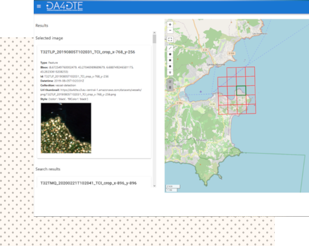
Asking questions in natural language and starting a conversation with the Digital Assistant to search for geospatial data.
Innovative CV and NLP techniques for Content-Based Image Retrieval (CBIR) applied to satellite acquisition data.
Multi-modal search technologies leveraging advanced algorithms to process and relate different types of data inputs, such as text and images.